
The Tenerife Travel Guide: Towns, Training Grounds, and the Real Cost of Island Life
- Pavł Polø
- 1 day ago
- 9 min read

Why This Tenerife Travel Guide Exists
You've seen the postcards. Black volcanic beaches, a snow-capped volcano you can drive to in shorts, year-round 70-degree weather. This Tenerife travel guide cuts through the postcard and gives you the operational details — distances, elevations, training facilities, and the supply-chain realities residents deal with that nobody puts in a brochure. This isn't a fluff piece. It's a briefing.
Before you book anything, here are the pain points most travelers and relocators hit blind:
North coast and south coast have completely different climates and personalities — picking the wrong base ruins a trip.
Public transport between towns is workable but infrequent in the mountains and west coast.
Fresh food costs more and runs short faster than mainland Spain — and most visitors never figure out why until they're standing in front of a half-empty produce aisle.
Mount Teide's elevation changes everything from training conditions to driving time, and most itineraries don't account for it.
"Tenerife" isn't one experience. Puerto de la Cruz and Costa Adeje are nearly different countries.
Looking for Music for self-development, going through life, traveling, and enjoying life. 🇵🇱 — Muzyka na samorozwój, jak osoba idzie przez życie, podróże, i jak osoba docenia życie.
Listen/Follow Pavł Polø on Spotify.
Getting to Tenerife: Distance, Boats, and Flight Reality
Tenerife sits in the Atlantic, roughly 300 km (186 miles) off the northwest coast of Africa — closer to the Sahara than to Madrid. From mainland Spain, you're looking at 1,290–1,390 km by sea. No, you don't need a boat to get there for a normal trip — direct flights from Madrid, Barcelona, and most major European hubs land at one of two airports: Tenerife South (TFS, the main one, serving the resort-heavy south) and Tenerife North (TFN, 20 minutes from Puerto de la Cruz, about 60 minutes from the south).
If you want to bring a car, a motorcycle, or you're relocating long-term, ferries run from Cádiz and Huelva on mainland Spain, operated by Naviera Armas and Fred Olsen Express. Expect 32 to 44 hours at sea, overnight, with stops in Lanzarote and Gran Canaria. This is not a budget shortcut — flights are almost always cheaper and faster. The ferry is for cargo, vehicles, and people in no hurry.
The Towns: Where to Base Yourself
Each entry below covers distance from the capital (Santa Cruz de Tenerife), elevation, the unique selling point, amenities, training options, and what kind of traveler it suits.
1. Puerto de la Cruz — The Original, North Coast
Distance from Santa Cruz | 36 km (about 35–40 min by car or TITSA bus) |
Elevation | Sea level |
Unique angle | Black volcanic sand, the César Manrique-designed Lago Martiánez saltwater pool complex, and a town that's stayed authentically Canarian rather than Anglicized. |
Amenities | Full medical services, banks, a casino, Loro Parque (one of Europe's top zoos), botanical gardens dating to 1788. |
Training & self-development | Open-water swimming year-round, hiking access to the Orotava Valley, and a calmer, less tourist-saturated environment for deep work or a writing retreat. |
Best for | The traveler who wants real culture, not a resort bubble. |
2. La Orotava — Highest Town in Spain
Distance from Santa Cruz | 28 km southwest |
Elevation | Town center sits at roughly 400 m elevation. The municipality itself stretches from sea level to 3,718 m at the summit of Mount Teide, making it the highest and steepest municipality in Spain. |
Unique angle | UNESCO-recognized colonial architecture, the famous Casa de los Balcones (1632), and the Corpus Christi flower carpets — a serious cultural event. |
Amenities | Boutique hotels, wine bodegas (Denominación de Origen Valle de la Orotava), local artisan markets. |
Training & self-development | Altitude exposure without the commitment — useful for runners and cyclists doing graduated altitude work before pushing higher onto Teide's slopes. |
Best for | History-minded travelers and anyone training for altitude who doesn't want to commit to a full mountain camp yet. |

3. San Cristóbal de La Laguna — The UNESCO Brain of the Island
Distance from Santa Cruz | Roughly 9 km, connected by the Tenerife Tram (Tranvía) — frequent, cheap, no car needed. |
Elevation | Around 550 m, noticeably cooler than the coast. |
Unique angle | A UNESCO World Heritage old town that served as the literal blueprint for colonial city layouts across Latin America, including Havana. |
Amenities | University town — University of La Laguna means a young population, strong nightlife, cafes, and lower prices than resort areas. |
Training & self-development | Home to a real academic ecosystem — language schools, university extension courses, and a far more intellectually active scene than the coast. |
Best for | Anyone wanting culture, study, and a break from tourist-driven pricing. |
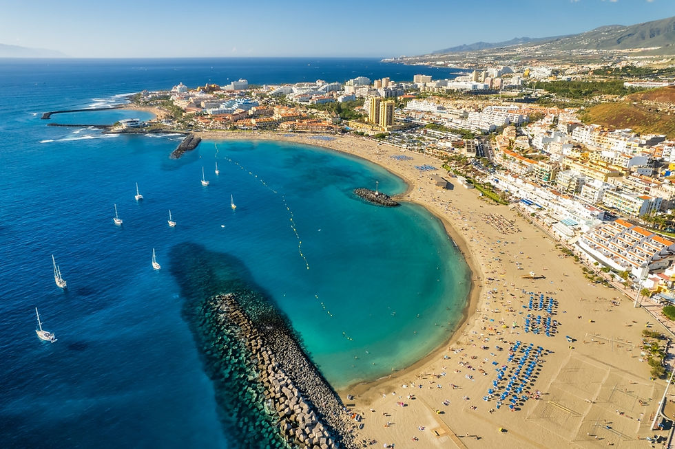
4. Costa Adeje & La Caleta — South Coast, High-Performance Zone
Distance from Santa Cruz | Around 75–80 km south (closer to Tenerife South Airport, about 20 minutes). |
Elevation | Sea level |
Unique angle | This is the south's polished, resort-grade strip — manufactured golden sand beaches (the sand itself is imported, since the island's natural sand is volcanic black), upscale dining, and the densest concentration of serious sports infrastructure on the island. |
Amenities | 5-star hotels, marinas, golf courses, premium healthcare clinics. |
Training & self-development | This is the real story for performance-minded travelers. Tenerife Top Training (T3) in La Caleta is a 56,620 m² high-performance complex with a 50m and 25m pool, a hydrodynamic flume channel, full-size natural-grass football pitches, a CrossFit box, and tennis and padel courts — used by national European teams for training camps. Nearby, the Abama Tennis Academy runs 7 tournament-grade courts with Flexi-Pave surfacing (the same surface family used at the US and Australian Opens), built for ATP and ITF-level play. |
Best for | Athletes, serious amateurs, and anyone running a training camp or wanting a performance-driven trip rather than a lounge-chair one. |
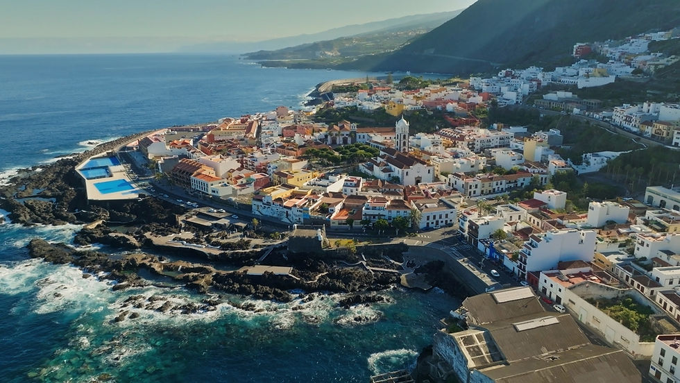
5. Garachico — The Comeback Town
Distance from Santa Cruz | 52 km west |
Elevation | Sea level, sitting beneath a 500+ meter cliff face. |
Unique angle | Buried by a volcanic eruption in 1706, rebuilt from the ashes — literally. Now known for natural volcanic rock seawater pools instead of beaches. |
Amenities | Small-scale: family-run restaurants, a handful of boutique guesthouses, minimal big-resort infrastructure. |
Training & self-development | Open-water swimming in the natural pools, coastal trail running, and a slower pace suited to a digital detox or reflective stretch of a trip. |
Best for | Travelers who want quiet, history, and zero crowds. |
🏆 GOLD NUGGET — Pick Your Coast, Not Just Your Town North coast (Puerto de la Cruz, La Orotava, Garachico) means authentic Canarian culture, black volcanic sand, and cooler, cloudier weather. South coast (Costa Adeje, Los Cristianos) means manufactured golden beaches, resort polish, and reliable sun. Choosing the wrong coast for your goals is the single most common planning mistake in any Tenerife travel guide — decide what you actually want before you pick a hotel. |

Mount Teide: The Elevation That Changes Everything
At 3,718 meters (12,198 ft), Mount Teide is Spain's highest peak and the highest point in the Atlantic Ocean. A cable car runs from roughly 2,356 m up toward the summit area, and the volcano's presence is the reason Tenerife pulls off a trick almost no destination can: you can be swimming in the Atlantic at sea level and standing in near-alpine, occasionally snow-dusted terrain inside the same afternoon. Driving up from the coast, plan for clouds rolling in after midday, especially in the La Orotava valley — start early if Teide National Park is on the agenda.
Self-Development and Training Opportunities
This island isn't just a beach trip. The infrastructure for serious physical and mental development is real:
Altitude and endurance training: Cyclists and runners use the climb from Costa Adeje up through Teide National Park as legitimate high-altitude conditioning — gradients and elevation gain rival anything in mainland Europe.
Tennis and padel: Abama Tennis Academy and the Tenerife Tennis Academy at T3 run year-round programs for players from beginner to professional tour level.
Swimming and triathlon: T3's flume channel and Olympic-distance pools attract national swim teams for winter training camps, since the climate allows outdoor training in January that most of Europe can't offer.
Academic and language immersion: La Laguna's university ecosystem offers Spanish-language courses and short academic programs in a genuinely local (not touristy) setting.
Mental reset: Garachico and the Anaga Rural Park's hiking trails offer the kind of low-stimulation, nature-heavy environment suited to disconnecting and resetting — no gimmicks required.
Island Lifestyle vs. Regular Life: What Actually Changes
Living here long-term — not just visiting — reshapes daily life in ways that don't show up in a travel brochure:
Time moves differently. Shops close for siesta, dinner starts late, and the pace of business is noticeably slower than mainland Europe or the US.
Everything is geographically compressed. You can go from beach to volcano to forest in under two hours — there's no other place in Europe where that's true.
Isolation is real, even with tourists everywhere. Being 300 km from Africa and 1,300+ km from mainland Spain means residents are genuinely cut off from rapid mainland logistics — a fact that shapes pricing, healthcare specialist availability, and how quickly anything ordered online actually arrives.
Weather is a non-issue, which changes planning entirely. With a stable subtropical climate nearly year-round, locals plan outdoor training, work, and social life without the seasonal disruption mainlanders deal with.
The Struggle Residents Don't Advertise: Food Supply and the Import Problem
Here's the part most travel content skips entirely, and it matters if you're considering more than a vacation. The Canary Islands import an estimated 80% of everything consumed locally from mainland Spain, according to reporting from Canarian Weekly. That dependency isn't a minor inconvenience — it's structural.
Academic research backs this up. A peer-reviewed study published in Shima: The International Journal of Research into Island Cultures on food sufficiency in the Canary Islands documents how the archipelago's small land area, limited arable soil, and water scarcity force heavy reliance on imported food — and how the cost of shipping in small, infrequent batches drives prices up compared to mainland Spain.
How goods actually arrive: According to logistics data analyzed by the Rhenus Group, roughly 91% of all imports from mainland Spain to the Canary Islands move through the ports of Tenerife and Las Palmas (Gran Canaria), arriving by cargo ship, not air — air freight accounts for barely 0.12% of total trade volume. Most cargo ships make scheduled runs just a couple of times per week.
That logistics model creates predictable cracks:
Perishables hit hardest. Fruits, vegetables, meat, and dairy are the first categories to run short whenever shipping is disrupted, since there's no buffer stock for items with a short shelf life.
Labor disputes on the mainland become local shortages.
Even staple crops aren't immune. Papas arrugadas (wrinkled Canarian potatoes) are a cultural cornerstone — yet a contaminated UK potato shipment combined with a weak local harvest triggered a real shortage, rationed purchases, and restaurants pulling the dish from menus, as documented in a firsthand account on In The Balance.
Tourism multiplies the strain. Research published via MYRIAD-EU notes the islands must feed roughly ten million annual tourists on top of around two million residents, putting sustained pressure on food, energy, and water resources alike.
🏆 GOLD NUGGET — Don't Assume Mainland Spain Pricing or Stock Levels If you're relocating or staying long-term, budget more for groceries — especially fresh produce, meat, and dairy — than you would on the mainland, and don't expect supermarket shelves to behave like a major mainland city. A single mainland transport disruption can empty island shelves of perishables within a week. Build a small pantry buffer; locals already do. |

Fact-Check Summary
Every figure in this guide was checked against current sourcing as of June 2026:
Mount Teide elevation (3,718 m / 12,198 ft) confirmed via Wikipedia and Grokipedia geographic data.
La Orotava town elevation (~400 m) and municipality range (sea level to 3,718 m) cross-confirmed across Wikipedia and topographic mapping sources.
Distance from Tenerife to the African coast (~300 km) and to mainland Spain (~1,290–1,390 km by sea route) confirmed via Ferryhopper and Direct Ferries routing data.
80% import-dependency figure sourced directly from Asuican (Association of Supermarkets of the Canary Islands) reporting via Canarian Weekly.
91% port-concentration and 0.12% air-freight figures sourced from Rhenus Group logistics analysis.
T3 / Tenerife Top Training facility specs (56,620 m², pool dimensions, court counts) confirmed via the facility's own listing and independent travel review aggregators.
Five Gold Nuggets: The Takeaway
Coast determines character. North coast (Puerto de la Cruz, Garachico) is authentic and quieter; south coast (Costa Adeje) is polished resort territory with imported golden sand and the island's best training infrastructure.
You don't need a boat — but you might want one. Flights are faster and cheaper for normal trips; ferries (32–44 hours from Cádiz or Huelva) are for vehicles and long-term relocation only.
Elevation is the island's secret weapon. From sea level to 3,718 m at Teide, Tenerife offers altitude training, cooler highland towns, and sea-to-summit access unmatched in Europe.
Costa Adeje is a legitimate performance hub. T3 and Abama Tennis Academy host national teams and tour-level athletes — this isn't just a beach destination.
Food security is the island's real Achilles' heel. With roughly 80% of consumption imported and fragile shipping logistics, residents live with a supply chain vulnerability tourists rarely notice — until the shelves go empty.


Comments