
TOP 10 TENERIFE NATURE HIKING SPOTS: The Young Traveler’s Field Guide to Hikes, Vistas & Wild Coastlines
- Pavł Polø
- 1 day ago
- 9 min read

SEO Keyword: Tenerife nature hiking
Last Updated: April 2026 • ~1,200 Words • Canary Islands, Spain
Tenerife presents itself as a unique hiking and adventure destination because you have topographical changes and well as landscape changes in a small area. Nature, hiking, and adventure offer the ability to gain understanding, talk about personal problems, and you talk to people about things if you go with people.
With what goes in today’s society everyone needs an escape from daily stress, pressure, and etc.
Why Tenerife Hits Different
Most people land in Tenerife and head straight for a sunlounger. That’s their loss. Pull up the island on satellite view and you’ll see what actually matters: a dormant volcano pushing 3,715 meters above sea level, ancient laurel forests that predate the ice age, black sand beaches carved by lava, and coastlines that plunge straight into the Atlantic. You’re looking at the most topographically diverse island in Spain — all packed into 2,034 km².
What separates Tenerife from the rest of the Canaries — and from most European destinations — is the sheer vertical range. You can start a morning at a volcanic beach, hit a pine forest by midday, and stand above the clouds by afternoon. No other island in the region gives you that. It’s the kind of place that rewards the guy who parks the 4x4, throws on the boots, and goes to find it himself.
Common pain points for first-time Tenerife nature travelers:
Underestimating trail difficulty and elevation gain at altitude
Not booking Teide summit permits in advance (they sell out weeks ahead)
Getting caught by calima — Saharan dust storms that spike temperatures and reduce visibility
Leaving valuables in rental cars at trailheads (theft is a known issue)
Starting hikes too late and running out of daylight in remote barrancos
Looking for Music for self-development, going through life, traveling, and enjoying life. 🇵🇱 — Muzyka na samorozwój, jak osoba idzie przez życie, podróże, i jak osoba docenia życie.
Listen to Pavł Polø on Spotify.
⚠️ Current Weather & Trail Conditions — April 2026
April is one of the best months on the island. Coastal highs of 19–23°C, 8–10 hours of sun daily, and minimal rainfall make it prime Tenerife nature hiking season. That said, watch for these conditions:
⚠️ WARNING: A Yellow Dust Suspension Warning (calima) has been flagged for April 2026. Saharan dust can cut visibility, spike temperatures significantly at altitude, and irritate airways. Check AEMET (Spanish Met Office) before heading into the hills.
⚠️ WARNING: Teide National Park summit temperatures can be 10–15°C colder than the coast — traces of snow are still possible. Layer up.
⚠️ WARNING: Rockfalls and landslides remain a risk in narrow ravines (barrancos) after any rainfall. Masca Canyon hike access is regulated with mandatory permits due to rescue incidents.
Live alerts: AEMET Official Warnings • AccuWeather Tenerife

Top 10 Tenerife Nature Hiking Spots — Hiker’s Breakdown
1. Mount Teide & Roques de García — Teide National Park
The crown of the island. Spain’s highest peak and a UNESCO World Heritage site. You don’t need to summit to get your fix — the Roques de García loop alone is one of the most surreal landscapes in Europe.
Distance: 5 km loop (Roques circuit) | 9.4 km to upper Teide slopes via Montaña Blanca
Elevation gain: 160 m (loop) | ~800 m (Montaña Blanca route)
Difficulty: Easy (loop) — Score: 6/10 | Moderate-Hard (summit approach) — Score: 8/10
Vista: Caldera rim, lava fields, and Roque Cinchado — the “leaning rock” that appears on the 1,000 peseta note
Flora/Fauna: Tajinaste rojo (tower of jewels) blooms in June, Canary Island pine, kestrels, lizards
Watch out: Altitude sickness above 3,000 m. Summit requires a GRATIS permit booked at
reservasparquesnacionales.es — books up weeks in advance.
Warm-up: Hip circles, leg swings, calf raises, and 5-minute brisk walk at trailhead before ascending.
2. Anaga Rural Park & Benijo–Chamorga Circuit
The northeast’s ancient laurel forest (laurisilva) is a UNESCO Biosphere Reserve. It’s primordial, misty, and nothing like the south of the island. The Benijo–Chamorga circuit is the gold-standard Anaga day hike.
Distance: ~12 km circuit
Elevation gain: ~600–800 m
Difficulty: Moderate-Hard — Score: 7/10 | Duration: 5–6 hours
Vista: Panoramic views of the Macizo de Anaga, dramatic coastal cliffs, Atlantic horizon
Beach access: Playa de Roque de las Bodegas (black sand, dramatic rock formations)
Flora/Fauna: Canary Island laurel, til trees, tree heather, Bolle’s pigeon (endemic), Laurel pigeon
Watch out: Limited parking at Benijo — arrive before 8 a.m. Trails get slippery when wet.
Warm-up: Ankle rotations, forward lunges, torso twists. The descent sections are steep — quad warm-up is essential.
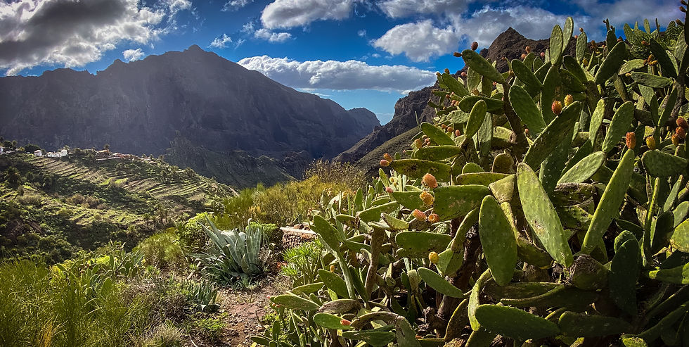
3. Masca Canyon — Parque Rural de Teno
One of the most dramatic gorge hikes in the Atlantic. You descend through a volcanic ravine carved over millions of years to a remote black-pebble beach. Boat transport back is mandatory (and worth it — the Los Gigantes cliffs from sea level are jaw-dropping).
Distance: ~7 km one way
Elevation loss: ~700 m (descent only)
Difficulty: Hard (steep, rocky, loose terrain) — Score: 8/10
Beach: Playa de Masca — remote black pebble cove accessible only on foot or by boat
Flora/Fauna: Cardón cactus (giant candelabra euphorbia), wild tabaibas, ospreys
Watch out: Permit system required. Tenerife now charges access fees due to over-tourism and rescue incidents. Book boat return in advance.
Warm-up: Glute activation, hip flexor stretches, balance exercises. You’ll be navigating loose volcanic rock.
4. Barranco del Infierno (Hell’s Gorge) — Adeje
South Tenerife’s best-kept natural secret. A protected Special Natural Reserve limited to 300 visitors per day. The gorge path follows a shepherd’s trail to a seasonal waterfall — one of Tenerife’s few.
Distance: 6.7 km return
Elevation gain: 350 m
Difficulty: Moderate — Score: 6/10
Vista/POI: 200m waterfall at trail’s end, towering basalt walls, old threshing floors
Flora/Fauna: Dragon tree (Dracaena draco), native ferns, kestrels
Watch out: Reserve tickets online in advance —
barrancoDelinfierno.com. 8.50€ entry for non-residents. Entry is time-slotted.
Warm-up: Hip flexor stretch, quad stretch, wrist mobilization for rock scramble sections.

5. Paisaje Lunar (Lunar Landscape) — Vilaflor
One of the island’s oldest trails, part of the Camino Real de Chasna that the Guanche people walked 500+ years ago. Eroded pumice formations create shapes that look genuinely extraterrestrial — a photographer’s dream.
Distance: ~13 km (PR TF 72 loop)
Elevation gain: ~400 m through Canarian pine forest
Difficulty: Moderate — Score: 6/10
Vista: Otherworldly rock formations, Mount Teide backdrop, pine-scented canyon air
Flora/Fauna: Canary Island pine (pino canario), Tenerife lizard, endemic blue chaffinch
Watch out: Loose volcanic pumice underfoot. Wear boots with grip, not trail runners.
Warm-up: Calf stretches, IT band stretch, slow ascent pace for first 15 minutes.
6. Rambla de Castro Coastal Trail — Puerto de la Cruz
A natural reserve trail cutting through palm-lined cliffs and lava formations above the north coast. It ends at Playa de Castro, a black rock beach with a waterfall that flows directly onto the sand. Serious Bali-in-the-Atlantic energy.
Distance: ~6 km return
Elevation gain: ~150 m
Difficulty: Easy-Moderate — Score: 5/10
Vista/Beach: Mirador San Pedro viewpoint, Playa de Castro with waterfall
Flora/Fauna: Canary Island date palms, coastal succulents, migratory seabirds
Watch out: Narrow cliff-side sections — not suitable if you have a fear of heights. Access is managed.
Warm-up: Shoulder rolls, ankle mobility, quad stretch before the coastal descent.
7. Siete Cañadas — Teide National Park
This long-form traverse of the Las Cañadas caldera rewards those willing to commit. Volcanic geology at its most raw — minerals bleed into the rock in deep reds, ochres, and blacks. June hikers catch the tajinaste rojo in full bloom.
Distance: ~23 km point-to-point (or shortened sections)
Elevation: 2,100–2,200 m throughout
Difficulty: Hard (long distance, altitude) — Score: 8/10
Vista/POI: Roque del Capricho, La Cañada de Diego Hernández, caldera views
Flora/Fauna: Teide daisy (Argyranthemum tenerifae), Teide violet (endemic), Teide wall lizard
Watch out: Limited shade, altitude effects, moufñon control hunting closures during certain periods.
8. Montaña Roja Natural Reserve — El Médano
A compact but punchy hike on a red volcanic mountain near the south airport. Fast to complete, stacked with views. The reserve also protects nesting loggerhead sea turtles on Playa de la Tejita — Tenerife’s longest natural beach.
Distance: 4 km return
Elevation gain: 130 m | Duration: 1.5–2 hours
Difficulty: Moderate (loose gravel near summit) — Score: 5/10
Vista/Beach: 360° southern coast views, Playa de la Tejita — Tenerife’s largest natural beach
Flora/Fauna: Canary Island spurge, nesting loggerhead sea turtles (protected zone), Barbary falcon
Watch out: Loose scree near the summit. Do not access the turtle nesting zones on the beach.
Warm-up: Ankle mobilization, lateral band walks, calf raises before the steep loose-gravel final push.
9. Punta del Hidalgo to Chinamada — Anaga
A raw coastal-to-mountain route that rises from the ocean to the clifftop hamlet of Chinamada, where people still live in cave dwellings. It’s authentically weird, wildly beautiful, and barely on most tourists’ radar.
Distance: 9.2 km return | Duration: 3–3.5 hours
Elevation gain: 627 m
Difficulty: Moderate — Score: 7/10
Vista: Sea cliffs, Chinamada cave village, northeast Anaga coastline
Flora/Fauna: Laurisilva species, cliff-adapted plants, Canary Island chiffchaff (endemic bird)
Watch out: Steep ascent in sections. Take water — no facilities on route.
10. Guajara Summit Circuit — Teide National Park
The third-highest point on the island and the highest point along the Teide caldera rim. Less visited than Teide itself but arguably better views — you look down into the caldera on one side and out to La Gomera and El Hierro on the other.
Distance: ~10 km circuit | Duration: 4.5 hours
Elevation gain: ~560 m | Max elevation: 2,715 m
Difficulty: Moderate-Hard — Score: 7/10
Trailhead: Parador Nacional de las Cañadas del Teide
Vista: Bird’s-eye caldera panorama, interisland views on clear days
Flora/Fauna: Teide broom (retama del Teide), white-tailed laurel pigeon, kestrels
Watch out: Exposed ridgeline — high winds can develop quickly. Check AEMET before departure.
Warm-up: 10-minute incline walk from parking area, dynamic hip openers, calf raises.

The Science of Being Out There — Nature & Mental Health
There’s a reason you feel clearer after a morning in the mountains. The research is solid: a 2024 systematic review in Current Psychology confirmed that nature-based walking interventions consistently improve mood, optimism, and mental well-being in adults. A 2023 randomized controlled trial published in the International Journal of Environmental Research and Public Health found that both mountain hiking and forest therapy produced significant mental health benefits in previously sedentary adults. And a 2024 meta-analysis by University of Utah researchers found that even 10 minutes in nature yielded measurable short-term benefits for adults dealing with mental illness.
Tenerife nature hiking delivers all three stimuli — movement, elevation, and immersion in non-urban environments — that repeatedly show up in the literature as most effective. The laurel forests of Anaga, the volcanic silence of Las Cañadas, the sound of Atlantic surf at Playa de Masca: these aren’t spa treatments. They’re proven stress modulators. Cortisol drops. Rumination quiets. You’re back to baseline.

5 Gold Nuggets — Take These With You
GOLD NUGGET: Book Teide Before You Fly — The free summit permit at reservasparquesnacionales.es books out weeks ahead. If you wait until you arrive, you’ll miss it. Book the day you confirm your flights.
GOLD NUGGET: Altitude Changes Everything — The summit of Teide is 3,715 m. Even at 2,000 m in the caldera, acclimatization matters. If you feel a headache or nausea, descend immediately. Never underestimate thin air.
GOLD NUGGET: Start Early, Always — Park spaces at Anaga and Masca fill by 9 a.m. in high season. Arriving at first light is not being extra — it’s the move. You’ll also avoid the worst of the midday heat.
GOLD NUGGET: Watch the Weather Alerts, Not Just the Forecast — The AEMET four-tier alert system (Green, Yellow, Orange, Red) is more useful than any weather app. A Yellow alert for rain in the mountains can mean flash flood risk in the ravines. Check it daily.
GOLD NUGGET: Gear Matters — The island racks up a high number of emergency call-outs from unprepared tourists. Grade B hiking boots, a windproof layer, 2 liters of water minimum, sun protection, and a downloaded AllTrails map are your minimum load-out. Non-negotiable.
References & Clickable Links
Fact-checked April 2026. Trail conditions subject to change — always verify with local tourist offices before departure.


Comments